


Blount Springs, Blount County, Alabama
About
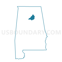
Outline

Summary
| Unique Area Identifier | 521235 |
| Name | Blount Springs |
| County | Blount County |
| State | Alabama |
| Area (square miles) | 14.96 |
| Land Area (square miles) | 14.78 |
| Water Area (square miles) | 0.18 |
| % of Land Area | 98.82 |
| % of Water Area | 1.18 |
| Latitude of the Internal Point | 33.93372420 |
| Longtitude of the Internal Point | -86.81875850 |
Maps


Graphs
Select a template below for downloading or customizing gragh for Blount Springs, Blount County, Alabama


Neighbors
Neighoring Voting District (by Name) Neighboring Voting District on the Map
- Colony Town Hall, Cullman County, AL
- Garden City Town Hall, Cullman County, AL
- Hayden, Blount County, AL
- Moody Town Union Hill Church, Cullman County, AL
- Mt. High, Blount County, AL
- Smoke Rise, Blount County, AL
- Sugar Creek, Blount County, AL
Top 10 Neighboring County Subdivision (by Population) Neighboring County Subdivision on the Map
- Hayden CCD, Blount County, AL (12,844)
- Bremen CCD, Cullman County, AL (8,283)
- Hanceville CCD, Cullman County, AL (7,499)
- Blountsville CCD, Blount County, AL (7,330)
Top 10 Neighboring Place (by Population) Neighboring Place on the Map
Top 10 Neighboring Unified School District (by Population) Neighboring Unified School District on the Map
Top 10 Neighboring State Legislative District Lower Chamber (by Population) Neighboring State Legislative District Lower Chamber on the Map
Top 10 Neighboring State Legislative District Upper Chamber (by Population) Neighboring State Legislative District Upper Chamber on the Map
Top 10 Neighboring 111th Congressional District (by Population) Neighboring 111th Congressional District on the Map
Top 10 Neighboring Census Tract (by Population) Neighboring Census Tract on the Map
- Census Tract 506.02, Blount County, AL (8,923)
- Census Tract 505, Blount County, AL (7,329)
- Census Tract 9655, Cullman County, AL (5,631)
- Census Tract 9654.02, Cullman County, AL (4,189)
- Census Tract 506.01, Blount County, AL (3,922)